The most advanced EFB, built with revolutionary safety capability for low-level flight — and a complete ecosystem to accompany it.


Free. Every feature, no subscription.

The most advanced EFB, built with revolutionary safety capability for low-level flight — and a complete ecosystem to accompany it.
Free. Every feature, no subscription.
Terrain, obstacles, airspace and TFRs on one dark chart, drawn to stay legible in daylight at five hundred feet. Download the region and the whole thing works with no signal at all.
10.3 million obstacles, alerted by direction and closing speed rather than a beeping radius — and after the warning, it shows you which wire.
Go deeper +Routes that understand elevation and turbulence, with a vertical profile of what you will clear and what you will not.
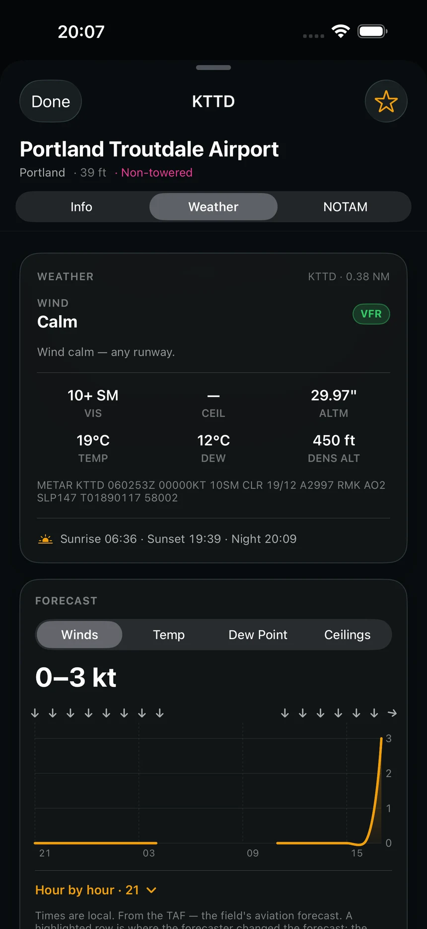
METARs, TAFs and winds aloft along the whole route, not just at the two ends of it.
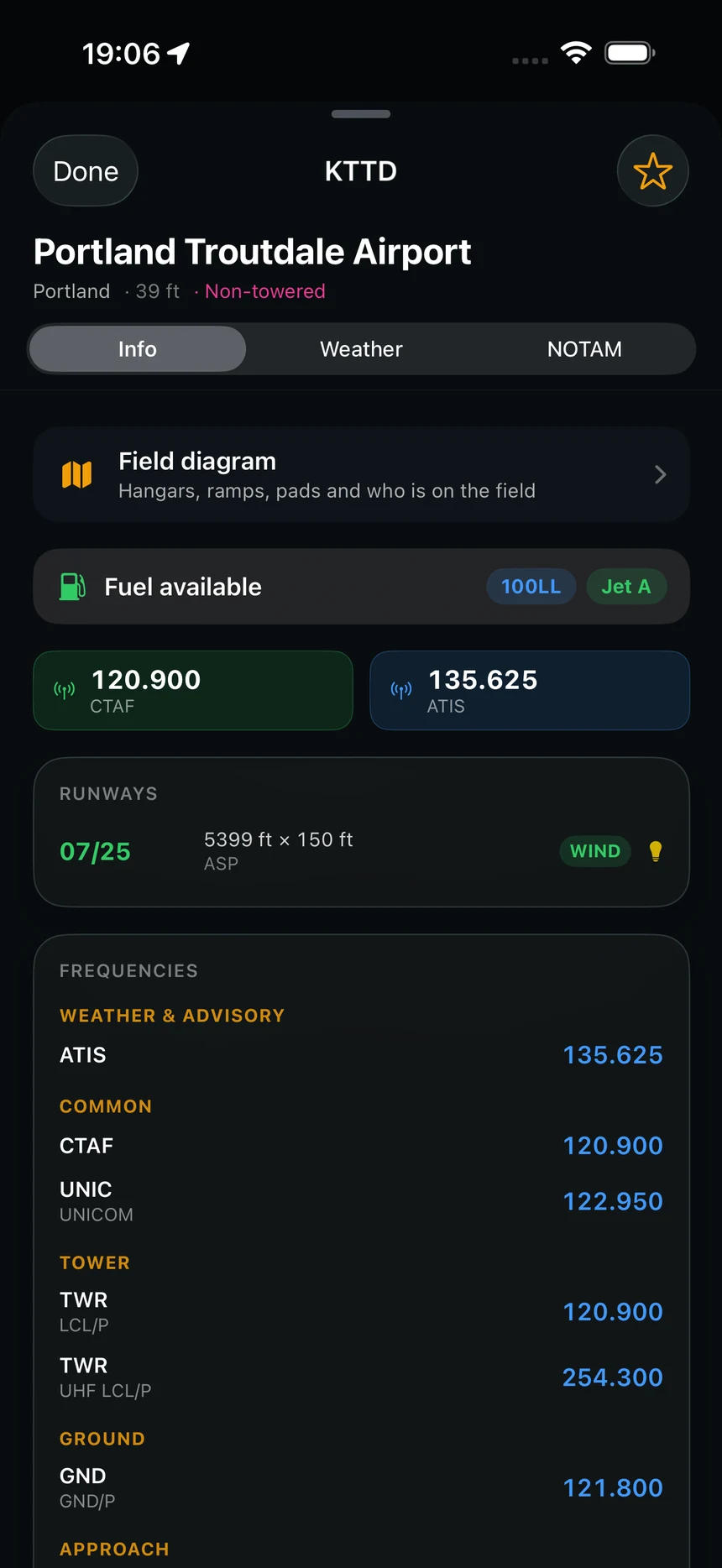
85,616 airports and 6,070 heliports: diagrams, frequencies and runway data — plus the owner's phone number on US helipads, for when the question is who to call for permission to land.
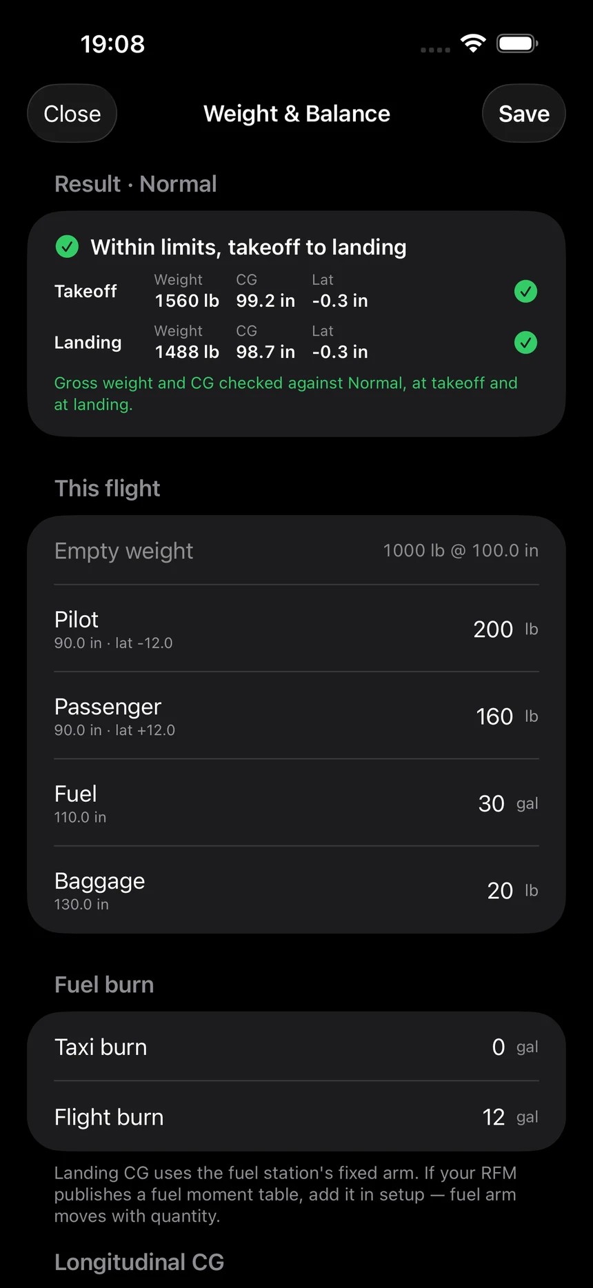
Your aircraft's real envelope, checked before you lift, with the numbers written straight into the record.
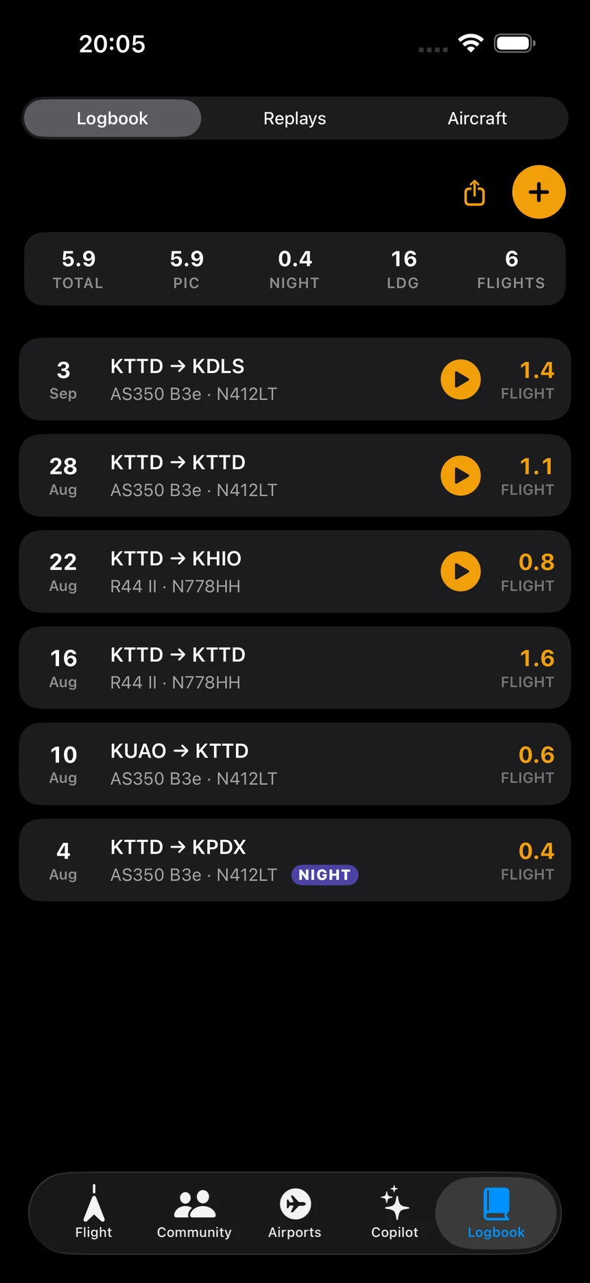
Hours that fill themselves in from the flight you just flew — including external load and night vision time.
Fly the track back afterwards: altitude, groundspeed and every alert that fired, for debriefs and for training.
Sentry, Stratus, Stratux and GDL 50 — sub-second direct reception, drawn on the same map, plus TIS-B and ADS-R the internet cannot see.
Write the clearance down the way you already do — a pre-ruled ATIS pad you can scribble on with a finger, and clear with one tap.
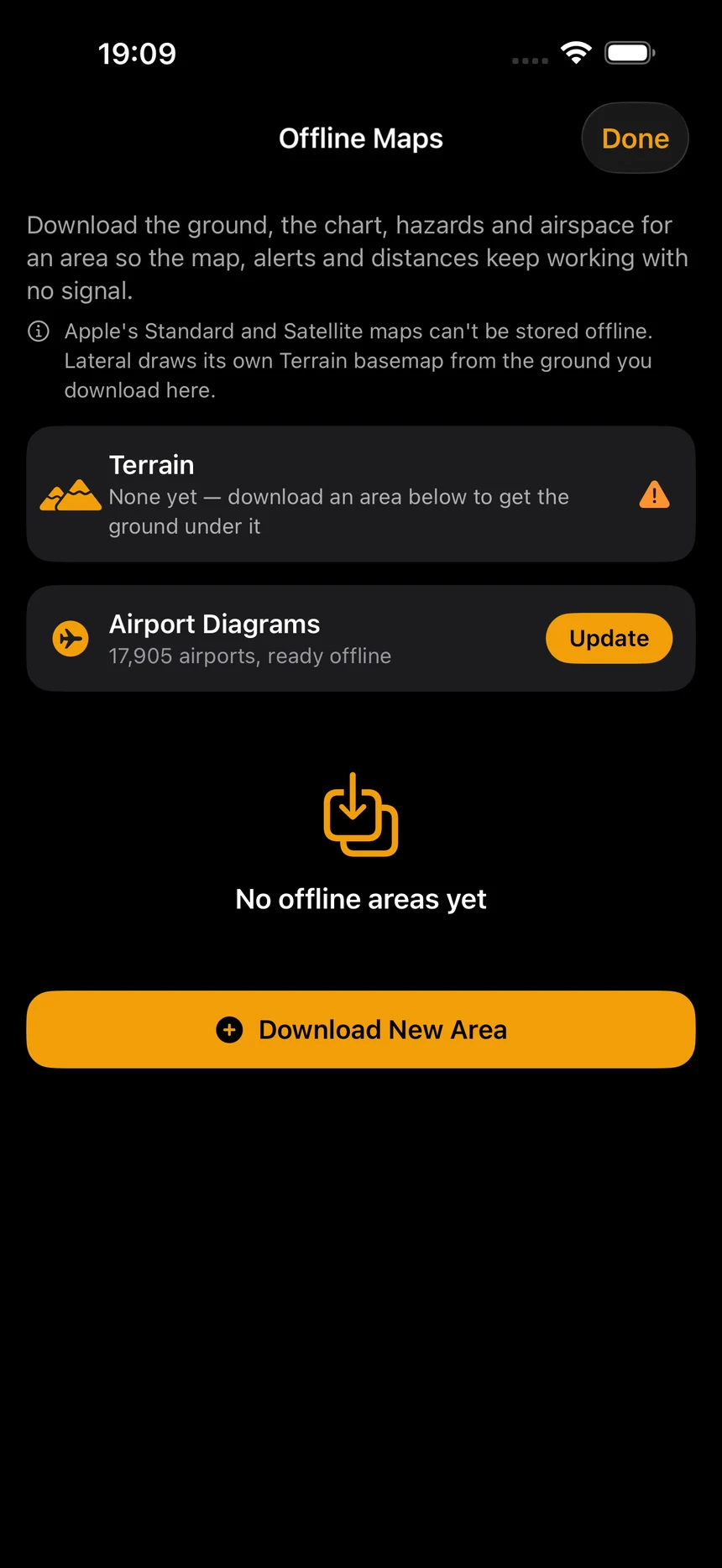
Download the region before you go. Maps, obstacles, terrain and airports all work with no signal at all — which is where the job usually is.
Draw straight onto the map with a finger — a boundary, a search pattern, the bit of ground you are working. One finger draws, two move the map, and it saves with the flight.
One feature among many. The one nobody else has.
It watches everything below two thousand feet — and only speaks when something crosses your path.
Powered by R2 Risk Engine
See how it thinks +It says it out loud. A spoken callout names the hazard, its bearing and how far — so your eyes never come inside to read a screen.
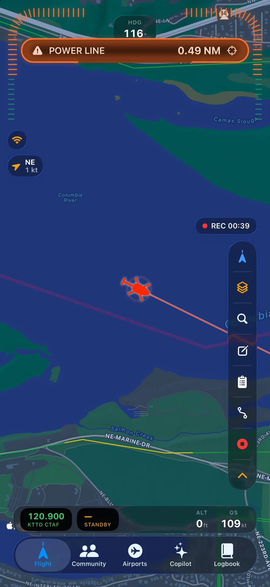
And it stays on the Island. Bearing and distance live at the top of the phone, updating, whatever app you are in.


One database · both worlds
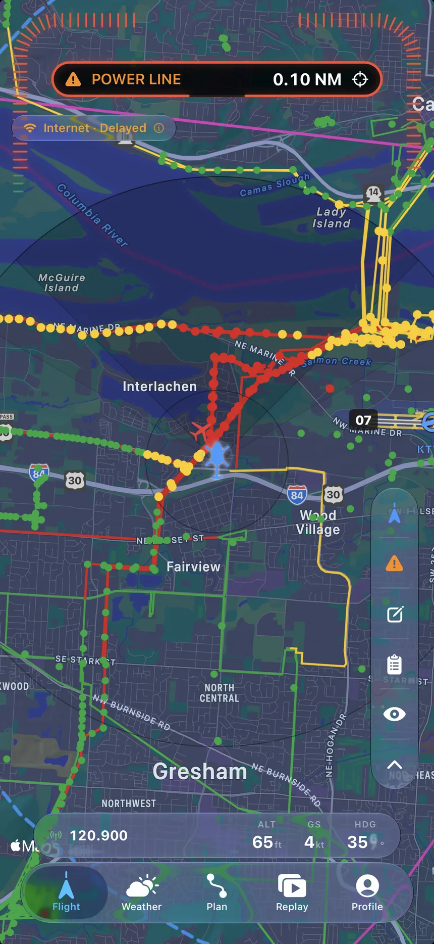
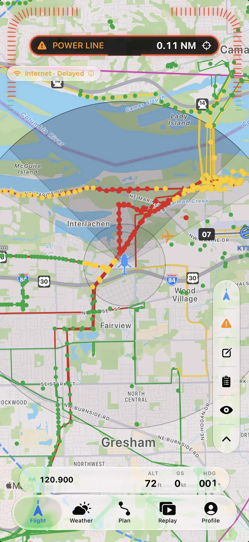
The Flight tab renders every span around you — ownship, radius rings, the full network. When one threatens your path, the banner fires.
POWER LINE — 0.10 NMThe directional cone narrows and points ahead as speed builds, and opens back up when you slow.

Plan at a desk, fly on the iPad. The same planning brain, on a full-size screen — routes, terrain, weather and briefs that sync straight to the aircraft.


Hours, maintenance, currency and obstacle exposure — per airframe and per pilot, straight from the flights your crews already fly.

Aircraft, instructors and students on one calendar. Double-booking is impossible, and the schedule knows the day each airframe grounds.

Forecasting the first two thousand feet — mechanical turbulence, rotor, valley fog. The layer everyone else barely resolves.

Openings matched against the hours in your logbook, and aircraft, avionics and parts listed by the people who own them.